Imagine soaring through the air, effortlessly capturing high-resolution images and videos of vast landscapes, intricate structures, and remote areas. This vision, once relegated to science fiction, is now a reality thanks to the powerful combination of drones and computer vision.
Drones, also known as Unmanned Aerial Vehicles (UAVs), offer unparalleled access and maneuverability, allowing them to reach previously inaccessible locations. Their ability to hover, fly autonomously, and capture data at various angles makes them ideal for monitoring and inspection tasks across various industries.
Computer vision, a branch of artificial intelligence, empowers drones with the ability to “see” and interpret the visual data they capture. Algorithms trained on vast amounts of images can automatically detect anomalies, identify objects, track movements, and even predict potential risks.
This powerful synergy creates a revolutionary tool for aerial monitoring and inspection, offering significant benefits over traditional methods:
Increased Efficiency and Accuracy: Drones can cover vast areas quickly and easily, capturing data at a much higher resolution than traditional methods. This allows for more accurate and efficient inspections, reducing time and costs.
Improved Safety: By eliminating the need for personnel to access potentially dangerous or hazardous areas, drones significantly improve safety during inspection tasks. This is particularly crucial in industries like construction, mining, and power lines.
Enhanced Data Collection: Drones can capture data from various angles and vantage points, providing a more comprehensive picture of the asset being inspected. This data can then be analyzed using computer vision algorithms to detect even the smallest anomalies, leading to better decision-making.
Real-time Insights: Drones can livestream video and data to ground control stations, allowing for real-time monitoring and analysis. This enables immediate responses to potential issues, preventing accidents and minimizing downtime.
Here are some specific applications of drones and computer vision for aerial monitoring and inspection:
Infrastructure Inspection: Bridges, buildings, pipelines, and other critical infrastructure can be inspected for cracks, corrosion, and other damage using drones equipped with high-resolution cameras and computer vision algorithms.
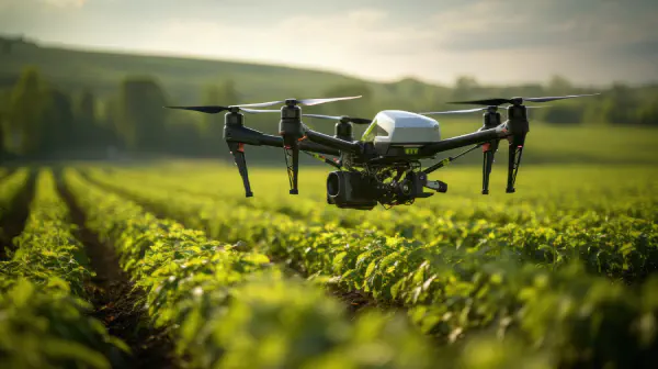
Agriculture: Drones can monitor crop health, identify pests and diseases, and assess irrigation needs, helping farmers optimize their yield and resource usage.
Construction: Drones can monitor construction progress, track inventory, and identify safety hazards, improving efficiency and reducing risks on construction sites.
Environmental Monitoring: Drones can track deforestation, monitor pollution levels, and map wildlife populations, contributing to environmental protection efforts.
Search and Rescue: Drones can search for missing persons in disaster zones or remote areas, significantly improving the chances of survival.
Conclusion 🏁
The future of drones and computer vision in aerial monitoring and inspection is incredibly promising. As technology advances and regulations evolve, we can expect to see even wider adoption of this technology across various industries. This will revolutionize the way we monitor and inspect infrastructure, assets, and the environment, leading to improved safety, efficiency, and sustainability.